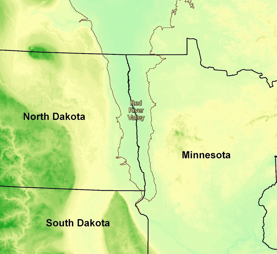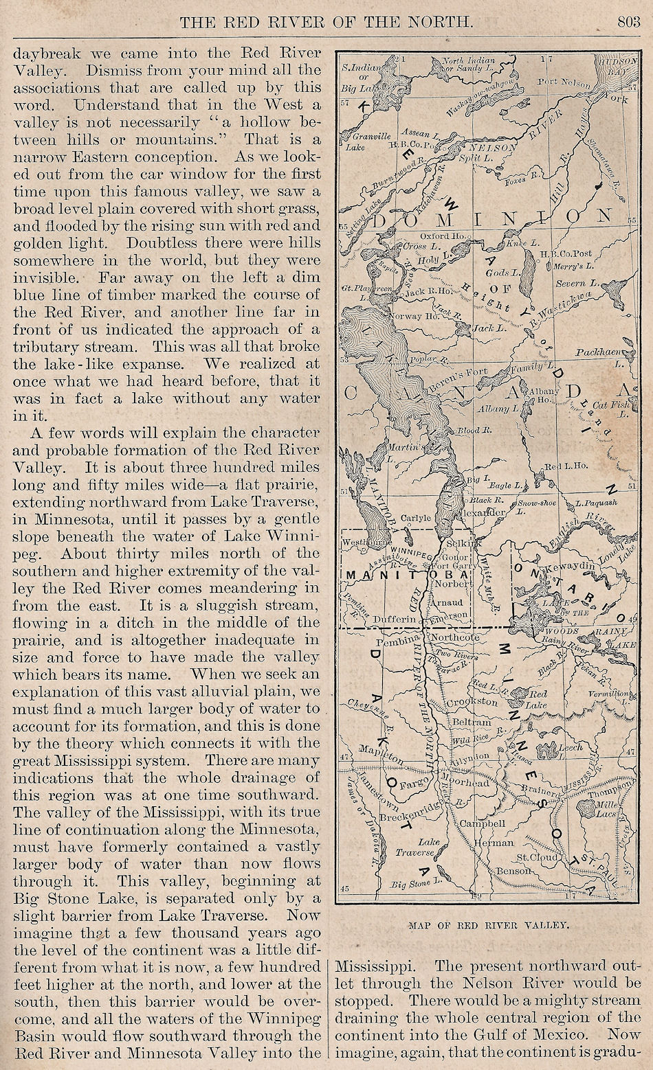
The valley of the Red River of the North properly extends from Lake Traverse on the south to Lake Winnipeg on the north, a distance of nearly five degrees of latitude, or over 300 miles. The width of the valley proper will average about 100 miles, though all the country drained by it, embraces a much wider scope. In places, especially on the west, the boundary of the valley is sharply marked by a sudden rising of the surface, and at the same time a sudden changing from the extremely level prairie to somewhat abrupt undulations. The geological theory of the formation of this level tract is that an ancient lake, or a inland sea, stretched from the north shores of the present Lake Winnipeg to Lake Traverse. The sudden rise in the land on the south and west are the ancient beaches of this lake, and the indications are convincing that it found its outlet through the Minnesota River, and finally the Mississippi. Then came a subsidence of the northern part of the continent, which turned the flow to the north, forcing the pent up waters of the present Lake Winnipeg to cut the channels of the Nelson and Churchill Rivers into Hudson Bay. Such changes in the earth’s surface were by no means infrequent during the early periods of the world; even now, portions of the continents are slowly rising while others are slowly falling. Such has undoubtedly been the history of this great lake, in whose ancient bed are now the magnificent fields and splendid rising cities of the “Golden Northwest.” During all this period the rivers from all directions brought their drift, fine particles of soil, and decaying vegetation from their shores, down into the still water of the lake, where it settled to the bottom. Added to this material, was the natural sediment of the lake itself, the decaying fishes and multitudes of water animals, giving it animal as well as vegetable fertilization. This process, going on for ages, gave us the unparalleled rich, fine, gritless soil of such remarkable depth. In course of time the water was all drained off, the zigzag channel along the middle, which served to keep it drained, becoming the present Red River of the North.
The climate is especially healthful and pleasant; temperate and bracing in summer, cold and dry in winter. The mean temperature is 44.6 degrees, corresponding with that of Michigan and New York. The summers rarely see the thermometer above 90 degrees, with the nights always cool, while the winter air ranges from above zero to 25 degrees below; once to twice in the history of the valley, during exceptionally hard winters, 48 degrees below zero was reached, but seldom is 35 degrees exceeded. The air is very dry, crisp and invigorating. We have none of the cold, damp, cutting blasts, and sudden changes from summer heat to arctic cold, which are so characteristic of States further south. The inhabitants are free from colds and incident diseases, and winter and summer the peculiar vitalizing and exhilarating air dispels all lassitude and languor, which may explain the wonderful energy and push of the people. Those who have lived here are unanimous in praise of the climate in both winter and summer.
Source:
Grand Forks Daily Herald
Wednesday Morning, March 22, 1882
Volume 1, Number 122, Page 2
